Maxar created a GPS alternative for drones based on 3D maps
Kyiv • UNN
Maxar has developed the Raptor system, which uses 3D maps to navigate drones without GPS. The system provides accurate determination of the coordinates of objects on the ground.

Currently, drones are increasingly used in combat operations, but they have one major weakness - they need GPS data. Maxar is working on a solution for situations where access to GPS is unavailable. A product called Raptor uses satellite mapping to create a 3D globe that can serve as an alternative to GPS. This is reported by UNN with reference to Dronedj.
Details
It is noted that drone operators will be able to use Raptor for precise navigation without GPS. The data collected by Maxar satellites is accurate and updated enough not only to control the drone but also to precisely determine the coordinates of ground objects. This capability will be useful in situations where the enemy blocks GPS in a certain area.
Raptor works with several pieces of software:
- Raptor Guide - loaded directly onto the drone to provide location data;
- Raptor Ace - installed on a laptop, which contains Maxar's 3D map and can provide latitude coordinates;
- Raptor Sync - can receive visual and other sensor readings from the drone and transmit them to Ace.
Thanks to Maxar's fleet of orbiting satellites, the company can provide a map of the entire globe for operations anywhere in the world. The company can also provide rapid updates for a specific region depending on user needs.
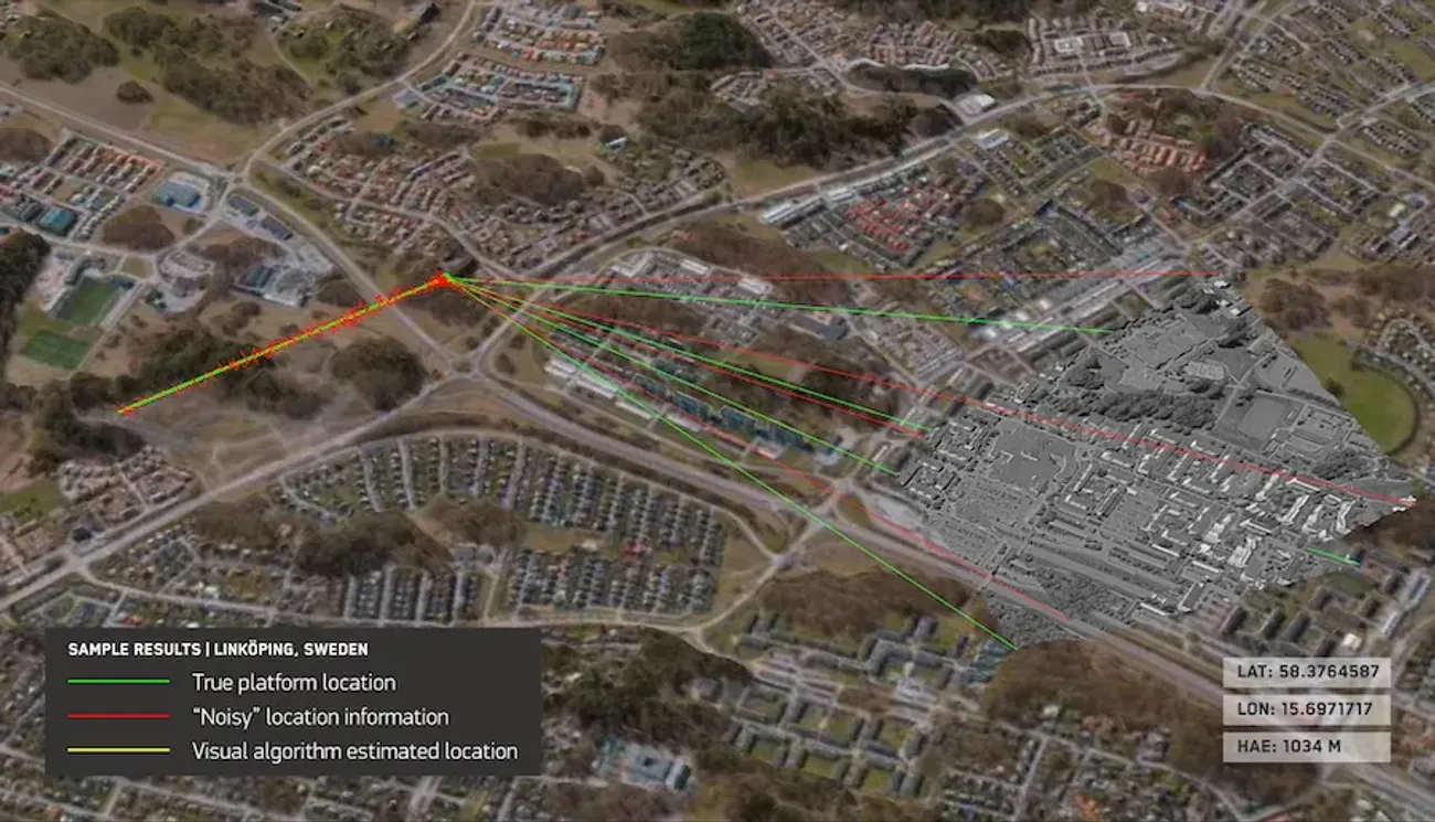
Raptor is somewhat inferior to GPS, as it can provide accurate coordinates for ground targets up to 3 meters away, but for now, it is the only alternative.
Raptor will be a game-changer for customers in the defense and commercial sectors. This software leverages Maxar's unique 3D global terrain data to ensure autonomous systems get the job done regardless of the GPS challenges they face.
Ukrainians will once again have access to Maxar satellite imagery12.03.25, 12:48 • 14133 views