First satellite images of Russian IL-76 crash site released
Kyiv • UNN
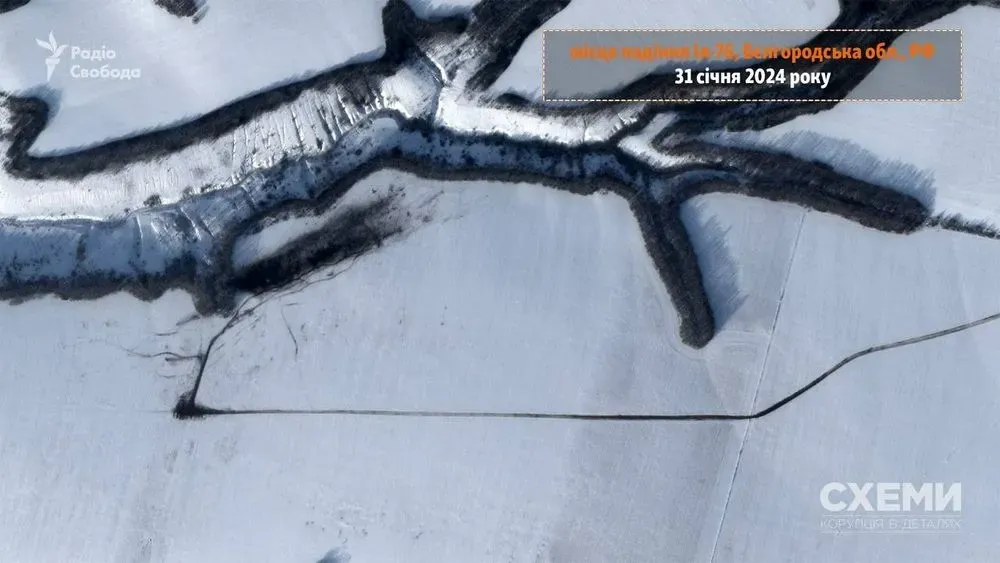
Satellite imagery from January 31 shows a 500-meter trail from the crash of a Russian Il-76 military transport plane that crashed near Belgorod on January 24.

Planet Labs satellite imagery from the crash site of a Russian Il-76 military transport aircraft near Belgorod has been posted online. UNN reports with reference to "Schemes."
Details
The photos were taken on January 31. They show the crash site of the IL-76.
It is noted that the trail left by the plane during the crash extends for about 500 meters.

Recall
On January 24, an Il-76 military transport plane crashed in the Korocha district of Belgorod region of Russia . the Russian Defense Ministry said that 65 Ukrainian prisoners of war were on board, who were being exchanged.
The Russians also immediately claimed that the plane was allegedly shot down by Ukraine.
The Main Directorate of Ukrainian Intelligence stated that there is currently no reliable and comprehensive information on who was on board the downed Russian Il-76 aircraft and in what number.
On January 31 , Russian dictator Vladimir Putin claimed that the IL-76 was shot down allegedly by the American Patriot system. This has allegedly been established by an expert panel.